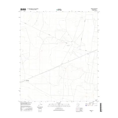
2016 Map of Owego
USGS Topo · Published 2016About this map
The Owego Oil Field anchors the landscape of this Pecos County region, illustrating the ongoing significance of the petroleum industry in West Texas during the mid-2010s. The terrain is defined by its industrial utility and sparse settlement, connected by long thoroughfares like Owego Rd and Woodward Rd. Small population centers or shipping points such as Baldridge and Owego appear as key landmarks in an otherwise open expanse, serving as essential reference points for local history and land use. The map captures a moment of modern energy production, where the infrastructure of the oil field sits alongside the traditional ranching and transportation routes that have shaped this portion of the state for decades.
Find a feature on this map
5 named features on this map. Tap any name to fly to it.
Don’t see what you’re looking for? This feature index may not catch every label — zoom into the map to look around manually.
Map Details
Editions of this 2016 Owego Map
This is the sole edition of this map. No revisions or reprints were ever made.
Other maps of this area
1928 · Crane
USGS Topo · 1:125,000
1928 · Comanche Spring
USGS Topo · 1:125,000
1929 · Independence Draw Quadrangle
USGS Topo · 1:125,000

1954 · Pecos
USGS Topo · 1:250,000

1954 · Fort Stockton
USGS Topo · 1:250,000

1957 · Pecos
USGS Topo · 1:250,000

1958 · Fort Stockton
USGS Topo · 1:250,000
1969 · Bootleg Canyon
USGS Topo · 1:24,000
1970 · East Mesa
USGS Topo · 1:24,000
1970 · Saddle Butte
USGS Topo · 1:24,000