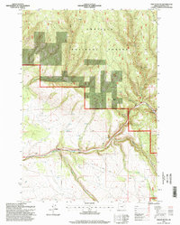
1995 Map of Owens Butte
USGS Topo · Published 1998About this map
Umatilla National Forest lands dominate this high-country survey of northeast Oregon, where the landscape is defined by the deep incisions of multiple drainages. The namesake Owens Butte rises above the junction of Owens Creek and other smaller tributaries, while the southern half of the map is shaped by the east-west corridor of Camas Creek. This waterway features a technical Gaging Station and a nearby Quarry, indicating the intersection of natural hydrology and resource management.
Find a feature on this map
14 named features on this map. Tap any name to fly to it.
Don’t see what you’re looking for? This feature index may not catch every label — zoom into the map to look around manually.
Map Details
Editions of this 1995 Owens Butte Map
This is the sole edition of this map. No revisions or reprints were ever made.
Other maps of this area

1953 · Pendleton
USGS Topo · 1:250,000

1956 · Pendleton
USGS Topo · 1:250,000

1967 · Ukiah SE
USGS Topo · 1:24,000

1967 · Lehman Springs
USGS Topo · 1:24,000

1967 · Granite Meadows
USGS Topo · 1:24,000

1967 · Pearson Ridge
USGS Topo · 1:24,000

1967 · Bridge Creek
USGS Topo · 1:24,000

1967 · Carney Butte
USGS Topo · 1:24,000

1967 · Ukiah
USGS Topo · 1:24,000

1967 · Owens Butte
USGS Topo · 1:24,000