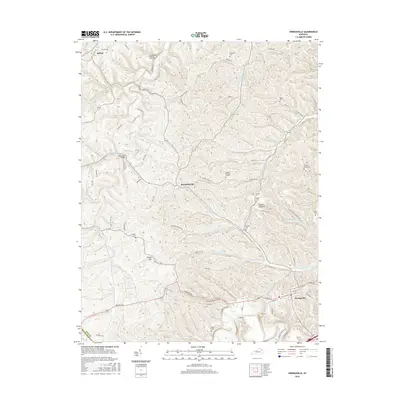
2016 Map of Owingsville
USGS Topo · Published 2016About this map
Owingsville and the surrounding Knobs region of Bath County are defined by a complex network of ridges and deep hollows where small settlements and family burial grounds persist. The landscape is characterized by the winding path of Flat Creek and its many tributaries, such as Minks Run and Prickly Ash Creek, which have carved out the terrain over millennia. For genealogists and local historians, the abundance of small family plots like the Gregory Burying Ground, Latham Graveyard, and Boaz Cem provides a detailed record of the families who settled these hillsides. Near the center of the sheet, the crossroads of Reynoldsville serves as a local landmark, while to the south, the historic Midland Trl passes through Owingsville, reflecting the path of early commerce and travel through this part of Kentucky. The high ground at White Oak Hill and Tunnel Hill offers a perspective on the traditional rural land use patterns that continue into the modern era.
Find a feature on this map
85 named features on this map. Tap any name to fly to it.
Don’t see what you’re looking for? This feature index may not catch every label — zoom into the map to look around manually.
Map Details
Editions of this 2016 Owingsville Map
This is the sole edition of this map. No revisions or reprints were ever made.
Other maps of this area

1929 · Salt Lick
USGS Topo · 1:62,500

1934 · Salt Lick
USGS Topo · 1:62,500

1951 · Hillsboro
USGS Topo · 1:24,000

1952 · Preston
USGS Topo · 1:24,000

1952 · Owingsville
USGS Topo · 1:24,000

1952 · Sharpsburg
USGS Topo · 1:24,000

1952 · Mount Sterling
USGS Topo · 1:24,000

1952 · Sherburne
USGS Topo · 1:24,000

1953 · Olympia
USGS Topo · 1:24,000

1953 · Moorefield
USGS Topo · 1:24,000