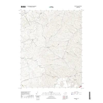
2019 Map of Owingsville
USGS Topo · Published 2019About this map
Owingsville serves as the primary hub in this portion of Bath County, situated where Slate Creek and several smaller branches meet. The landscape is defined by its numerous family burial grounds and historical meeting places, such as the Old Republican Meeting House Cem and the Gregory Burying Ground. These sites, along with smaller plots like the Latham Graveyard and Shields Cem, suggest a deeply rooted rural community structure.
Find a feature on this map
93 named features on this map. Tap any name to fly to it.
Don’t see what you’re looking for? This feature index may not catch every label — zoom into the map to look around manually.
Map Details
Editions of this 2019 Owingsville Map
This is the sole edition of this map. No revisions or reprints were ever made.
Other maps of this area
1929 · Salt Lick
USGS Topo · 1:62,500
1934 · Salt Lick
USGS Topo · 1:62,500
1951 · Hillsboro
USGS Topo · 1:24,000
1952 · Preston
USGS Topo · 1:24,000
1952 · Owingsville
USGS Topo · 1:24,000
1952 · Sharpsburg
USGS Topo · 1:24,000
1952 · Mount Sterling
USGS Topo · 1:24,000
1952 · Sherburne
USGS Topo · 1:24,000
1953 · Olympia
USGS Topo · 1:24,000
1953 · Moorefield
USGS Topo · 1:24,000