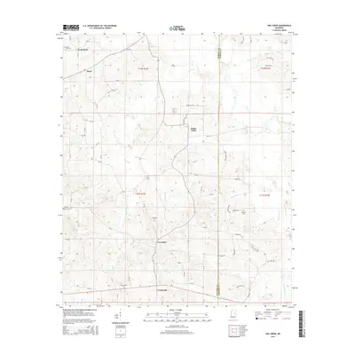
2015 Map of Owl Creek
USGS Topo · Published 2015About this map
Bogue Chitto and the eastern border of Neshoba County define this Mississippi landscape, where the tribal lands of the Mississippi Band of Choctaw Indians meet the rural countryside of Kemper County. The map reveals a dense network of country roads, such as CR-2831 and Fulton Rd, connecting dispersed settlements and family burial grounds across the rolling hills between Owl Creek and the Bogue Chitto river. For genealogists, the map is particularly rich in family-named sites, including Hensons Cem and Roundtree Cem, which provide geographic anchors for local heritage research. The drainage patterns of Coffadeliah Cr and Rea Ditch suggest a land historically shaped by timber and small-scale agriculture, where hamlets like Forestdale and Crossroads served as local nodes in a decentralized community structure.
Find a feature on this map
76 named features on this map. Tap any name to fly to it.
Don’t see what you’re looking for? This feature index may not catch every label — zoom into the map to look around manually.
Map Details
Editions of this 2015 Owl Creek Map
This is the sole edition of this map. No revisions or reprints were ever made.
Other maps of this area

1953 · Meridian
USGS Topo · 1:250,000

1957 · Meridian
USGS Topo · 1:250,000

1962 · House
USGS Topo · 1:24,000

1962 · Lynville
USGS Topo · 1:24,000

1962 · Vernon
USGS Topo · 1:24,000

1962 · Owl Creek
USGS Topo · 1:24,000

1962 · Preston
USGS Topo · 1:24,000

1962 · Moscow
USGS Topo · 1:24,000

1965 · Meridian
USGS Topo · 1:250,000
1972 · Noxapater
USGS Topo · 1:24,000