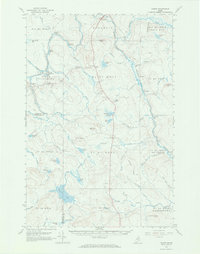
1965 Map of Oxbow
USGS Topo · Published 1969About this map
Oxbow Plantation and Masardis anchor this mid-1960s study of the deep northern Maine woods. The landscape is defined by the winding course of the Aroostook River, which carves through the timberland near Seven Islands and The Oxbow. This survey reflects an era of remote logging and sporting camps, noted by sites such as Camp Violette, Cold Spring Campsite, and McManus Camp.
Find a feature on this map
82 named features on this map. Tap any name to fly to it.
Don’t see what you’re looking for? This feature index may not catch every label — zoom into the map to look around manually.
Map Details
Editions of this 1965 Oxbow Map
3 editions found
Other maps of this area

1930 · Greenlaw
USGS Topo · 1:48,000

1931 · Ashland
USGS Topo · 1:48,000

1933 · Greenlaw
USGS Topo · 1:62,500

1934 · Ashland
USGS Topo · 1:62,500

1935 · Howe Brook
USGS Topo · 1:48,000

1935 · Presque Isle
USGS Topo · 1:62,500

1937 · Smyrna Mills
USGS Topo · 1:62,500

1939 · Howe Brook
USGS Topo · 1:62,500

1940 · Island Falls
USGS Topo · 1:62,500

1940 · Oxbow
USGS Topo · 1:62,500