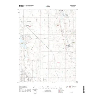
2019 Map of Oxford
USGS Topo · Published 2019About this map
Oxford serves as the academic and civic anchor for this region of Southwest Ohio, where the extensive campus of Miami University meets the Butler County Courthouse Annex. The landscape is defined by the winding paths of Fourmile Creek and Sevenmile Creek, which carve through the terrain near the ridge known as Devils Backbone. Rural heritage is preserved in landmarks like the Pughs Mill Covered Bridge, while the surrounding countryside is dotted with small family and community burial grounds, including John Ramsey Cem, Beechwood Cem, and Teague Cem. Settlement patterns follow the historic corridors connecting Camden and Somerville, with the northwestern corner featuring the recreational waters of Acton Lake. This survey captures the modern intersection of a major university town and its agricultural surroundings, from the small aviation strip at Joe Cimprich Airport to the various runs and creeks that feed the Great Miami River watershed.
Find a feature on this map
105 named features on this map. Tap any name to fly to it.
Don’t see what you’re looking for? This feature index may not catch every label — zoom into the map to look around manually.
Map Details
Editions of this 2019 Oxford Map
This is the sole edition of this map. No revisions or reprints were ever made.
Other maps of this area

1911 · Oxford
USGS Topo · 1:62,500

1915 · College Corner
USGS Topo · 1:48,000

1915 · Harrison
USGS Topo · 1:48,000

1915 · Hamilton
USGS Topo · 1:62,500

1917 · Hamilton
USGS Topo · 1:62,500

1918 · College Corner
USGS Topo · 1:62,500

1953 · Cincinnati
USGS Topo · 1:250,000

1955 · Hamilton
USGS Topo · 1:24,000

1955 · Reily
USGS Topo · 1:24,000
1955 · Millville
USGS Topo · 1:24,000