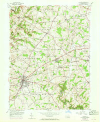
1953 Map of Oxford
USGS Topo · Published 1969About this map
Lincoln University anchors the central landscape of this Chester County survey, marking a significant educational and cultural hub just north of the borough of Oxford. The area is defined by a dense network of small rural settlements and family-named landmarks like Faggs Manor and Edenton. A mid-century infrastructure shift is visible as the Penn Central railroad tracks bisect the terrain, while sections of the Baltimore Pike are marked as under construction.
Find a feature on this map
58 named features on this map. Tap any name to fly to it.
Don’t see what you’re looking for? This feature index may not catch every label — zoom into the map to look around manually.
Map Details
Editions of this 1953 Oxford Map
4 editions found
Other maps of this area

1898 · Elkton
USGS Topo · 1:62,500

1900 · Elkton
USGS Topo · 1:62,500

1900 · Havre De Grace
USGS Topo · 1:62,500

1904 · Coatesville
USGS Topo · 1:62,500

1906 · Coatesville
USGS Topo · 1:62,500

1912 · Quarryville
USGS Topo · 1:62,500

1917 · Elkton
USGS Topo · 1:62,500

1918 · Coatesville
USGS Topo · 1:62,500

1942 · Havre De Grace
USGS Topo · 1:62,500

1942 · Elkton
USGS Topo · 1:62,500
Featured Places
- New London Township, PA
- Upper Oxford Township, PA
- Russellville, Upper Oxford Township
- Lower Oxford Township, PA
- East Nottingham Township, PA