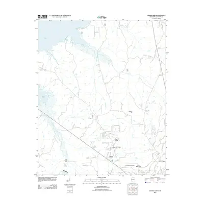
2012 Map of Oxford North
USGS Topo · Published 2012About this map
College Hill and its namesake College Hill Cem anchor this landscape north of the University of Mississippi, where the headwaters of Sardis Lake reach into the northwestern corner of the quadrangle. The terrain is defined by a series of drainages, including Toby Tubby Cr, Hurricane Cr, and Dunlap Br, which carve through the land towards the reservoir. Residential expansion is evident in developments like Tara Estates, Lakeway Gardens, and College Hill Heights. For local historians and genealogists, the map is a detailed record of many burial grounds, from the Saint Johns Cem near the lake to the North Oxford Cem and Toby Tubby Cem. The presence of the University-Oxford Airport at the southern margin indicates the growing infrastructure supporting the nearby university community during this early 21st-century period.
Find a feature on this map
114 named features on this map. Tap any name to fly to it.
Don’t see what you’re looking for? This feature index may not catch every label — zoom into the map to look around manually.
Map Details
Editions of this 2012 Oxford North Map
This is the sole edition of this map. No revisions or reprints were ever made.
Other maps of this area

1940 · Oxford
USGS Topo · 1:62,500

1942 · Denmark
USGS Topo · 1:62,500

1943 · Denmark
USGS Topo · 1:62,500

1943 · Oxford
USGS Topo · 1:62,500

1944 · Tyro
USGS Topo · 1:62,500

1944 · Potts Camp
USGS Topo · 1:62,500

1945 · Potts Camp
USGS Topo · 1:62,500

1956 · Tupelo
USGS Topo · 1:250,000

1958 · Tupelo
USGS Topo · 1:250,000

1971 · Laws Hill
USGS Topo · 1:24,000