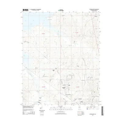
2015 Map of Oxford North
USGS Topo · Published 2015About this map
Sardis Lake defines the northwestern reaches of this Mississippi landscape, where the rolling Lafayette County terrain meets the impounded waters of the Tallahatchie River system. The northern outskirts of Oxford show significant residential expansion through developments like Lakeway Gardens, Tara Estates, and College Hill Heights. This 2015 survey provides a modern snapshot of the area's growth around the University-Oxford Airport while preserving the location of older rural anchors. Historic lineage is visible at the College Hill settlement, established long before the suburban push, and at numerous burial sites including Saint Johns Cem and the Toby Tubby Cem. The drainage patterns of Hurricane Cr and Toby Tubby Cr continue to shape the land use around Abbeville, illustrating the persistent intersection of old watercourses and modern infrastructure.
Find a feature on this map
98 named features on this map. Tap any name to fly to it.
Don’t see what you’re looking for? This feature index may not catch every label — zoom into the map to look around manually.
Map Details
Editions of this 2015 Oxford North Map
This is the sole edition of this map. No revisions or reprints were ever made.
Other maps of this area

1940 · Oxford
USGS Topo · 1:62,500

1942 · Denmark
USGS Topo · 1:62,500

1943 · Denmark
USGS Topo · 1:62,500

1943 · Oxford
USGS Topo · 1:62,500

1944 · Tyro
USGS Topo · 1:62,500

1944 · Potts Camp
USGS Topo · 1:62,500

1945 · Potts Camp
USGS Topo · 1:62,500

1956 · Tupelo
USGS Topo · 1:250,000

1958 · Tupelo
USGS Topo · 1:250,000

1971 · Laws Hill
USGS Topo · 1:24,000