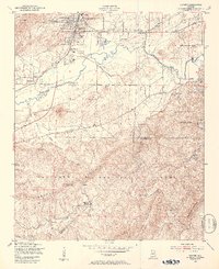
1947 Map of Oxford
USGS Topo · Published 1953About this map
Oxford Lake and the Southern Railway corridor anchor this post-war landscape where the city of Oxford meets the foothills of the Talladega National Forest. The map documents a diverse community structure, from the municipal hub of Anniston and the historic incorporated town of Hobson City to small, specialized settlements like Lardent and McAding. This 1947 field survey captures the area just as the Anniston Municipal Airport was becoming a regional fixture and rural life remained centered on country churches such as Pure Holiness Ch and Bethlehem Ch.
Find a feature on this map
44 named features on this map. Tap any name to fly to it.
Don’t see what you’re looking for? This feature index may not catch every label — zoom into the map to look around manually.
Map Details
Editions of this 1947 Oxford Map
2 editions found
Other maps of this area

1891 · Ashland
USGS Topo · 1:125,000

1900 · Anniston
USGS Topo · 1:125,000

1947 · Oxford
USGS Topo · 1:24,000

1947 · Anniston
USGS Topo · 1:24,000

1947 · Eulaton
USGS Topo · 1:24,000

1947 · Munford
USGS Topo · 1:24,000

1950 · Anniston
USGS Topo · 1:62,500

1953 · Atlanta
USGS Topo · 1:250,000

1954 · Choccolocco
USGS Topo · 1:24,000

1956 · Munford
USGS Topo · 1:24,000