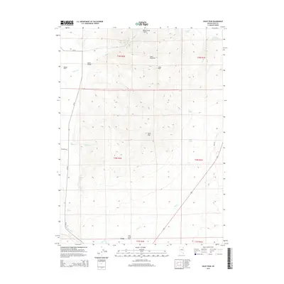
2014 Map of Oxley Peak
USGS Topo · Published 2014About this map
Oxley Peak stands as the central landmark of this high-desert landscape in northeastern Nevada, presiding over the rugged Snake Mountains. This 2014 survey captures the hydrologic importance of the area, where numerous water sources like Threemile Spring, Chicken Spring, and Winchell Spring punctuate the arid terrain. To the south, the Town Creek Flat transitions toward the settlement of Wells, while the Humboldt River brushes the southwestern edge of the quadrangle. The map reveals a land defined by water access and elevation, from the steep walls of Bishop Creek Canyon to the broader expanse of Bishop Flats. The presence of several Hot Springs and Chicken Seep Spring underscores the geothermal activity and delicate water network that has historically supported ranching and transit through these high basins. Primary access routes such as Metropolis Rd and Bar L Rd connect the remote mountain peaks to the valley floor.
Find a feature on this map
29 named features on this map. Tap any name to fly to it.
Don’t see what you’re looking for? This feature index may not catch every label — zoom into the map to look around manually.
Map Details
Editions of this 2014 Oxley Peak Map
This is the sole edition of this map. No revisions or reprints were ever made.
Other maps of this area

1955 · Wells
USGS Topo · 1:250,000

1958 · Wells
USGS Topo · 1:250,000

1961 · Wells
USGS Topo · 1:250,000

1967 · Black Butte
USGS Topo · 1:24,000

1967 · Welcome
USGS Topo · 1:24,000

1967 · Metropolis
USGS Topo · 1:24,000

1968 · Moor Summit
USGS Topo · 1:24,000

1968 · Wells
USGS Topo · 1:24,000

1968 · Melandco
USGS Topo · 1:24,000

1968 · Wells Peak
USGS Topo · 1:24,000