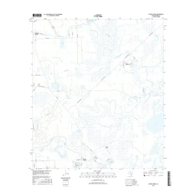
2016 Map of Oyster Creek
USGS Topo · Published 2016About this map
Bastrop Bayou and Austin Bayou meander through this coastal Texas landscape, defining a network of wetlands and tidal inlets near the Gulf. The settlement of Oyster Creek sits along its namesake waterway, surrounded by numerous named water bodies like Shank Lake, Stubblefield Lake, and Dutch Lake. Further north, the communities of Bastrop Beach and Mims mark the higher ground between the sloughs. For genealogists, the map identifies significant local burial sites including Hoskins Cem and Hudgens Cem. The intricate hydrology is further shaped by the Intracoastal Waterway in the southeast corner and the McCormack Reservoir Number 4 to the north, illustrating the complex management of water in this low-lying region of Brazoria County.
Find a feature on this map
59 named features on this map. Tap any name to fly to it.
Don’t see what you’re looking for? This feature index may not catch every label — zoom into the map to look around manually.
Map Details
Editions of this 2016 Oyster Creek Map
This is the sole edition of this map. No revisions or reprints were ever made.
Other maps of this area

1943 · Oyster Creek
USGS Topo · 1:31,680

1943 · Jones Creek
USGS Topo · 1:31,680

1943 · Danbury
USGS Topo · 1:31,680

1943 · Freeport
USGS Topo · 1:31,680

1943 · Angleton
USGS Topo · 1:24,000

1943 · Christmas Point
USGS Topo · 1:24,000

1943 · Chocolate Bay
USGS Topo · 1:24,000

1943 · Snipe
USGS Topo · 1:31,680

1950 · Houston
USGS Topo · 1:250,000

1951 · Bay City
USGS Topo · 1:250,000