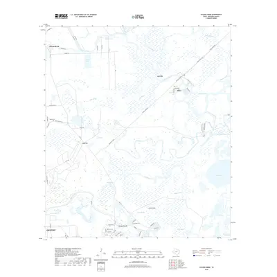
2019 Map of Oyster Creek
USGS Topo · Published 2019About this map
Bastrop Bayou and its sprawling network of tributaries dominate this coastal Texas landscape, where the land and sea interlace south of Alvin. The area is defined by intricate drainage patterns like Little Slough and Salt Bayou, which feed into larger bodies such as Square Island Lake and Salt Lake. The settlement of Bastrop Beach and the outskirts of Clute are connected by roads like FM 523, while local history is anchored by sites like Hoskins Cem and Hudgens Cem. This coastal geography reflects the essential role of water management and transport near the Intracoastal Waterway, where features like Slough Ridge rise subtly above the surrounding wetlands and bayous that have shaped the region's development.
Find a feature on this map
62 named features on this map. Tap any name to fly to it.
Don’t see what you’re looking for? This feature index may not catch every label — zoom into the map to look around manually.
Map Details
Editions of this 2019 Oyster Creek Map
This is the sole edition of this map. No revisions or reprints were ever made.
Other maps of this area

1943 · Oyster Creek
USGS Topo · 1:31,680

1943 · Jones Creek
USGS Topo · 1:31,680

1943 · Danbury
USGS Topo · 1:31,680

1943 · Freeport
USGS Topo · 1:31,680

1943 · Angleton
USGS Topo · 1:24,000

1943 · Christmas Point
USGS Topo · 1:24,000

1943 · Chocolate Bay
USGS Topo · 1:24,000

1943 · Snipe
USGS Topo · 1:31,680

1950 · Houston
USGS Topo · 1:250,000

1951 · Bay City
USGS Topo · 1:250,000