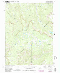
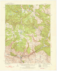
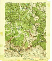
1977 Map of Oyster Lake
USGS Topo · Published 1988About this map
The Flat Tops plateau dominates this high-altitude landscape in the White River National Forest as it appeared during the late 1970s and 1980s. This territory is defined by a dense network of subalpine basins and glacial lakes, with the Flat Tops Wilderness Boundary separating the most protected reaches from the surrounding forest land. Elevations are marked by prominent summits such as Camel Peak and Rat Mountain, which oversee a complex drainage system including Papoose Creek and Marvine Creek.
Find a feature on this map
27 named features on this map. Tap any name to fly to it.
Don’t see what you’re looking for? This feature index may not catch every label — zoom into the map to look around manually.
Map Details
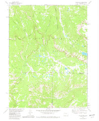
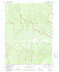
Editions of this 1977 Oyster Lake Map
4 editions found

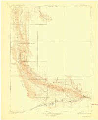
Other maps of this area

1906 · Grand Hogback
USGS Topo · 1:125,000

1910 · Danforth Hills
USGS Topo · 1:125,000
1910 · Grand Hogback
USGS Topo · 1:125,000
1927 · Glenwood Springs
USGS Topo · 1:125,000
1930 · Glenwood Springs
USGS Topo · 1:125,000

1954 · Craig
USGS Topo · 1:250,000

1957 · Craig
USGS Topo · 1:250,000

1957 · Leadville
USGS Topo · 1:250,000

1958 · Craig
USGS Topo · 1:250,000

1959 · Leadville
USGS Topo · 1:250,000