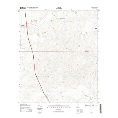
2014 Map of Ozan
USGS Topo · Published 2014About this map
Ozan and Springs Junction sit within the rolling terrain of central Alabama, where the landscape is defined by the winding paths of Buxahatchee Cr and Waxahatchee Cr. This 2014 survey documents the area's rural character as it transitions from the southern outskirts of Calera toward the Shelby and Chilton County line. The map is particularly valuable for genealogists, as it preserves the locations of numerous family and community burial grounds, including the Shiloh Busby Cem, Archers Chapel Cem, and Leach Cem. These landmarks, alongside smaller water bodies like Mitchell Lake and Gilberts Lake, reveal a settlement pattern deeply rooted in the local topography. The presence of South Calera and various residential drives near Timberline Trl indicates modern development patterns slowly extending into the traditional timber and agricultural lands of the region.
Find a feature on this map
81 named features on this map. Tap any name to fly to it.
Don’t see what you’re looking for? This feature index may not catch every label — zoom into the map to look around manually.
Map Details
Editions of this 2014 Ozan Map
This is the sole edition of this map. No revisions or reprints were ever made.
Other maps of this area

1890 · Bessemer
USGS Topo · 1:125,000

1891 · Clanton
USGS Topo · 1:125,000

1892 · Bessemer
USGS Topo · 1:125,000

1909 · Columbiana
USGS Topo · 1:62,500

1910 · Montevallo
USGS Topo · 1:62,500

1911 · Columbiana
USGS Topo · 1:62,500

1953 · Montgomery
USGS Topo · 1:250,000

1953 · Birmingham
USGS Topo · 1:250,000

1956 · Birmingham
USGS Topo · 1:250,000

1956 · Montgomery
USGS Topo · 1:250,000