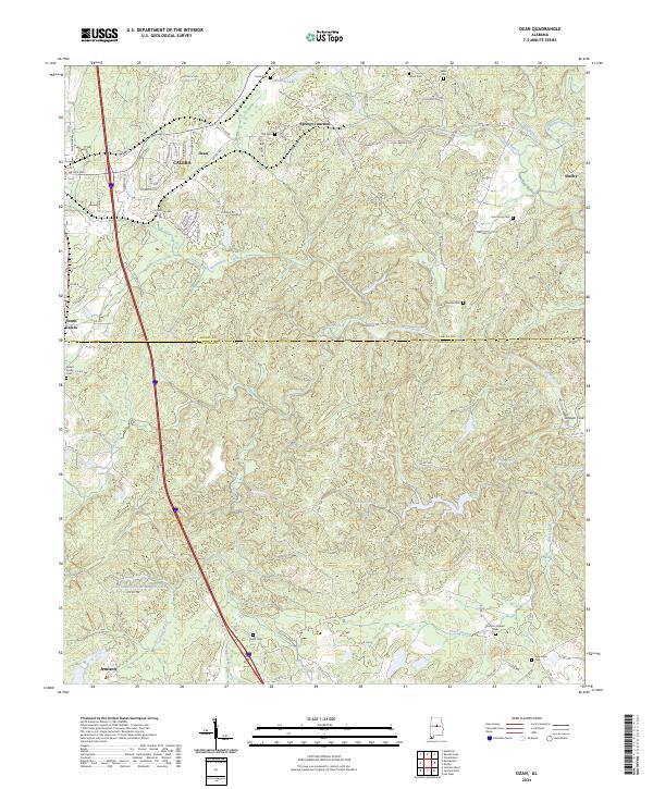
2024 Map of Ozan
USGS Topo · Published 2024About this map
The Shelby Co Chilton Co line divides this landscape, where the southern outskirts of Calera meet the rural reaches of Jemison. This area is defined by a dense network of small watercourses, including Buxahatchee Creek, Wash Creek, and Stumps Creek, which carve through the terrain near the Timberline Ridge. The settlement pattern is largely residential and agricultural, anchored by small communities like Ozan and Springs Junction.
Find a feature on this map
96 named features on this map. Tap any name to fly to it.
Don’t see what you’re looking for? This feature index may not catch every label — zoom into the map to look around manually.
Map Details
Editions of this 2024 Ozan Map
This is the sole edition of this map. No revisions or reprints were ever made.
Other maps of this area

1890 · Bessemer
USGS Topo · 1:125,000

1891 · Clanton
USGS Topo · 1:125,000

1892 · Bessemer
USGS Topo · 1:125,000

1909 · Columbiana
USGS Topo · 1:62,500

1910 · Montevallo
USGS Topo · 1:62,500

1911 · Columbiana
USGS Topo · 1:62,500

1953 · Montgomery
USGS Topo · 1:250,000

1953 · Birmingham
USGS Topo · 1:250,000

1956 · Birmingham
USGS Topo · 1:250,000

1956 · Montgomery
USGS Topo · 1:250,000