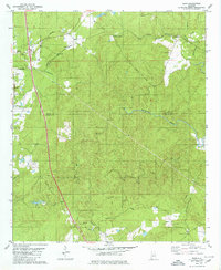
1979 Map of Ozan
USGS Topo · Published 1980About this map
Calera and South Calera anchor the western edge of this landscape, marking a period of rail-driven industrial and residential growth along the Southern and Louisville and Nashville railroads. The map records a rural network defined by creek basins and family-named sites, where the Shelby Co Chilton Co line divides the rolling wooded terrain. To the east, the settlement of Ozan and the junction at Springs Junction indicate historic transport hubs that served the surrounding agricultural and timber lands.
Find a feature on this map
29 named features on this map. Tap any name to fly to it.
Don’t see what you’re looking for? This feature index may not catch every label — zoom into the map to look around manually.
Map Details
Editions of this 1979 Ozan Map
This is the sole edition of this map. No revisions or reprints were ever made.
Other maps of this area

1890 · Bessemer
USGS Topo · 1:125,000

1891 · Clanton
USGS Topo · 1:125,000

1892 · Bessemer
USGS Topo · 1:125,000

1909 · Columbiana
USGS Topo · 1:62,500

1910 · Montevallo
USGS Topo · 1:62,500

1911 · Columbiana
USGS Topo · 1:62,500

1953 · Montgomery
USGS Topo · 1:250,000

1953 · Birmingham
USGS Topo · 1:250,000

1956 · Birmingham
USGS Topo · 1:250,000

1956 · Montgomery
USGS Topo · 1:250,000