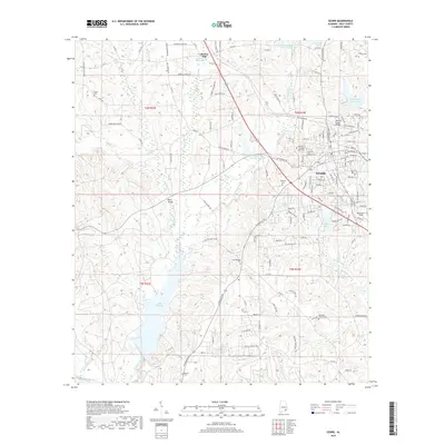
2018 Map of Ozark
USGS Topo · Published 2018About this map
Ozark serves as the focal point for this Southeast Alabama landscape, where the headwaters of numerous creeks like Claybank Creek and Hurricane Cr shape the terrain. The map documents a significant concentration of local heritage sites, including the historic Claybank Cem and Travelers Rest Cem within the city limits, while rural outskirts preserve the locations of Campground Cem and Old Dean Church Cem. To the west, the expansive Lake Tholocco dominates the drainage of Beaver Br, while to the north, the small settlement of Marley Mill sits adjacent to the Marley Millpond. The map reveals the area's transition from the dense street grid of the county seat to the forested creek bottoms and aeronautical facilities at Blackwell Field, providing a clear view of the regional infrastructure before the modern era.
Find a feature on this map
146 named features on this map. Tap any name to fly to it.
Don’t see what you’re looking for? This feature index may not catch every label — zoom into the map to look around manually.
Map Details
Editions of this 2018 Ozark Map
This is the sole edition of this map. No revisions or reprints were ever made.
Other maps of this area

1942 · Enterprise
USGS Topo · 1:125,000

1948 · Ozark
USGS Topo · 1:62,500

1948 · Brundidge
USGS Topo · 1:62,500

1950 · Ozark
USGS Topo · 1:62,500

1950 · Enterprise
USGS Topo · 1:62,500

1950 · Brundidge
USGS Topo · 1:62,500

1953 · Dothan
USGS Topo · 1:250,000

1954 · Dothan
USGS Topo · 1:250,000

1955 · Dothan
USGS Topo · 1:250,000

1960 · Ewell
USGS Topo · 1:24,000