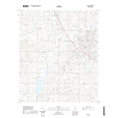
2020 Map of Ozark
USGS Topo · Published 2020About this map
Ozark serves as the focal point of this Dale County study, anchored by the Dale County Courthouse and the surrounding street grid. The landscape is defined by the complex drainage of Claybank Creek and its many tributaries, including Little Claybank Cr and Beaver Br. To the south, the expansive waters of Lake Tholocco dominate the terrain, reflecting the area's developed water resources alongside smaller impoundments like Marvin Parker Lake Number Two and D A Deloney Lake Number Two.
Find a feature on this map
144 named features on this map. Tap any name to fly to it.
Don’t see what you’re looking for? This feature index may not catch every label — zoom into the map to look around manually.
Map Details
Editions of this 2020 Ozark Map
This is the sole edition of this map. No revisions or reprints were ever made.
Other maps of this area

1942 · Enterprise
USGS Topo · 1:125,000

1948 · Ozark
USGS Topo · 1:62,500

1948 · Brundidge
USGS Topo · 1:62,500

1950 · Ozark
USGS Topo · 1:62,500

1950 · Enterprise
USGS Topo · 1:62,500

1950 · Brundidge
USGS Topo · 1:62,500

1953 · Dothan
USGS Topo · 1:250,000

1954 · Dothan
USGS Topo · 1:250,000

1955 · Dothan
USGS Topo · 1:250,000

1960 · Ewell
USGS Topo · 1:24,000