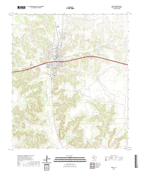
2022 Map of Ozona
USGS Topo · Published 2022About this map
Ozona serves as the focal point of this Crockett County survey, where the town’s grid is anchored by the Crockett County Courthouse. The geography is defined by a series of dry watercourses, most notably the winding Johnson Draw and Gurley Draw, which carve through the high plains landscape. Human impact on this arid environment is visible in the Soil Conservation Service Site 7 Reservoir, a significant water management feature located northeast of the town center. Local history and genealogy are well-represented by the nearby Cedar Hill Cem and Lima Cem, which sit just south of the main settlement area. The town’s modern connectivity is illustrated by the Ozona Municipal Airport and the corridor of Ranch Rd 2398 moving westward into the expansive West Texas terrain.
Find a feature on this map
41 named features on this map. Tap any name to fly to it.
Don’t see what you’re looking for? This feature index may not catch every label — zoom into the map to look around manually.
Map Details
Editions of this 2022 Ozona Map
This is the sole edition of this map. No revisions or reprints were ever made.
Other maps of this area

1954 · Sonora
USGS Topo · 1:250,000

1958 · Sonora
USGS Topo · 1:250,000

1967 · Ozona
USGS Topo · 1:24,000

1967 · Baggett Ranch
USGS Topo · 1:24,000

1967 · Double Mill Draw SE
USGS Topo · 1:24,000

1967 · Ozona SE
USGS Topo · 1:24,000

1967 · Indio Hill
USGS Topo · 1:24,000

1967 · Hunt Ranch
USGS Topo · 1:24,000

1967 · Crockett Heights
USGS Topo · 1:24,000
1967 · Schneeman Draw SE
USGS Topo · 1:24,000