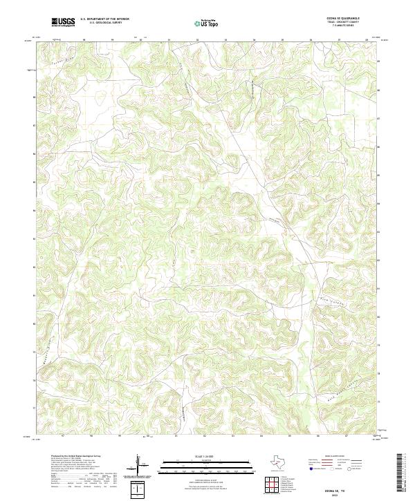
2022 Map of Ozona SE
USGS Topo · Published 2022About this map
Plum Canyon and Rock House Canyon define the drainage patterns of this Crockett County landscape, which is marked by a network of seasonal draws and canyons characteristic of the Edwards Plateau. This 2022 survey documents the contemporary rural infrastructure of the region, where Taylor Box Rd and Co Rd 101 provide essential access through the winding topography. Named watercourses such as Baggett Draw, Son Chapman Draw, and Tucker Draw highlight the importance of watershed geography in this arid environment. The map also traces Shaggy Canyon and Co Rd 103, illustrating the intersection of natural erosion features and modern county transit routes.
Find a feature on this map
10 named features on this map. Tap any name to fly to it.
Don’t see what you’re looking for? This feature index may not catch every label — zoom into the map to look around manually.
Map Details
Editions of this 2022 Ozona SE Map
This is the sole edition of this map. No revisions or reprints were ever made.
Other maps of this area

1954 · Sonora
USGS Topo · 1:250,000

1958 · Sonora
USGS Topo · 1:250,000

1967 · Nolen Draw
USGS Topo · 1:24,000

1967 · Ozona
USGS Topo · 1:24,000

1967 · Baggett Ranch
USGS Topo · 1:24,000

1967 · Ozona SE
USGS Topo · 1:24,000

1967 · Shafter Draw
USGS Topo · 1:24,000

1967 · Crockett Heights
USGS Topo · 1:24,000
1967 · Hospital Ranch
USGS Topo · 1:24,000

1969 · Wild Horse Canyon
USGS Topo · 1:24,000