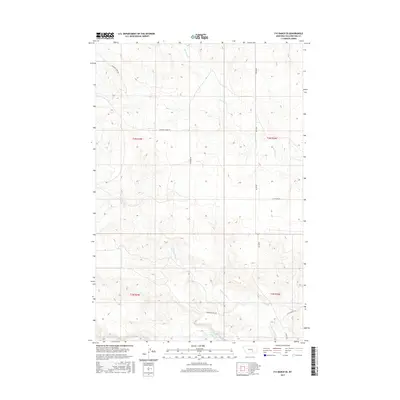
2017 Map of P K Ranch SE
USGS Topo · Published 2017About this map
Yellowstone River frontage and the drainage of Pompeys Pillar Cr define this pocket of Yellowstone County. The terrain is marked by the historical legacy of western expansion, most notably through the presence of Bozeman Trail Rd, which runs parallel to the river valley. The landscape is segmented by a grid of rural routes including Scothern Rd and Bundy Rd, supporting the agricultural and ranching operations of the region. Steep coulees and draws are carved by seasonal waterways like Railroad Cr, while landmarks such as Castle Butte Rd in the southeast suggest the proximity of prominent local geographic formations. This survey provides a clear view of the township and range boundaries where t4n r29e and t4n r30e meet, illustrating the modern management of these traditional ranching lands.
Find a feature on this map
13 named features on this map. Tap any name to fly to it.
Don’t see what you’re looking for? This feature index may not catch every label — zoom into the map to look around manually.
Map Details
Editions of this 2017 P K Ranch SE Map
This is the sole edition of this map. No revisions or reprints were ever made.
Other maps of this area

1893 · Huntley
USGS Topo · 1:125,000

1894 · Fort Custer
USGS Topo · 1:125,000

1954 · Billings
USGS Topo · 1:250,000

1954 · Hardin
USGS Topo · 1:250,000

1954 · Forsyth
USGS Topo · 1:250,000

1954 · Roundup
USGS Topo · 1:250,000

1957 · Hardin
USGS Topo · 1:250,000

1957 · Forsyth
USGS Topo · 1:250,000

1957 · Billings
USGS Topo · 1:250,000

1958 · Billings
USGS Topo · 1:250,000