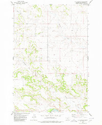
1980 Map of P K Ranch SE
USGS Topo · Published 1980About this map
Yellowstone River anchors the southern margin of this Yellowstone County landscape, where the valley floor transitions into the dissected uplands of south-central Montana. The terrain is defined by the drainages of Pompeys Pillar Creek and Railroad Creek, which carve through the sandstone breaks and ridges characteristic of the region north of the river. This 1970s-era topographic study highlights a rural environment dominated by water management and natural topography, with numerous wells scattered across the township sections to support livestock and land use. The map reveals the relationship between the river corridor and the high prairie, documenting the section lines and township boundaries of T 4 N and T 3 N that structured this part of the Big Sky country as it appeared in the late twentieth century.
Find a feature on this map
7 named features on this map. Tap any name to fly to it.
Don’t see what you’re looking for? This feature index may not catch every label — zoom into the map to look around manually.
Map Details
Editions of this 1980 P K Ranch SE Map
This is the sole edition of this map. No revisions or reprints were ever made.
Other maps of this area

1893 · Huntley
USGS Topo · 1:125,000

1894 · Fort Custer
USGS Topo · 1:125,000

1954 · Billings
USGS Topo · 1:250,000

1954 · Hardin
USGS Topo · 1:250,000

1954 · Forsyth
USGS Topo · 1:250,000

1954 · Roundup
USGS Topo · 1:250,000

1957 · Hardin
USGS Topo · 1:250,000

1957 · Forsyth
USGS Topo · 1:250,000

1957 · Billings
USGS Topo · 1:250,000

1958 · Billings
USGS Topo · 1:250,000