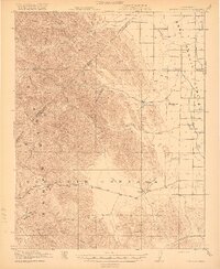
1920 Map of Pacheco Pass
USGS Topo · Published 1920About this map
The Diablo Range dominates the western half of this 1920 survey, dropping sharply into the agricultural expanse of the San Joaquin Valley to the east. This landscape represents a critical transit corridor before the modern era of highway expansion, centered on the ancient crossing at Pacheco Pass. The early industrial footprint of the region is visible through the Bald Eagle Mine tucked into the canyons and the Shell Pumping Sta on the valley floor, indicating the intersection of mineral extraction and burgeoning energy infrastructure.
Find a feature on this map
39 named features on this map. Tap any name to fly to it.
Don’t see what you’re looking for? This feature index may not catch every label — zoom into the map to look around manually.
Map Details
Editions of this 1920 Pacheco Pass Map
4 editions found
Other maps of this area

1913 · Panoche
USGS Topo · 1:125,000

1917 · Newman
USGS Topo · 1:31,680

1918 · Gustine
USGS Topo · 1:31,680

1919 · Orestimba
USGS Topo · 1:62,500

1919 · Orestimba Creek
USGS Topo · 1:31,680

1919 · Hollister
USGS Topo · 1:48,000

1919 · Ingomar
USGS Topo · 1:31,680

1920 · Pacheco Pass
USGS Topo · 1:62,500

1920 · Carrisalito Spring
USGS Topo · 1:31,680

1921 · Volta
USGS Topo · 1:31,680