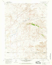
1958 Map of Pacific Springs
USGS Topo · Published 1967About this map
South Pass serves as the central focal point for this mid-century survey of the Wyoming high country, where the Continental Divide dictates the flow of the Sweetwater River to the east and Pacific Creek to the west. This area is steeped in the history of westward expansion, clearly preserving the paths of the Emigrant Trail and the Lander Pinedale Stage Road. Near the waters of Pacific Springs, the map identifies the Stage and Pony Express Sta Site, marking a vital link in 19th-century communication.
Find a feature on this map
23 named features on this map. Tap any name to fly to it.
Don’t see what you’re looking for? This feature index may not catch every label — zoom into the map to look around manually.
Map Details
Editions of this 1958 Pacific Springs Map
3 editions found
Other maps of this area

1953 · South Pass City
USGS Topo · 1:24,000

1955 · Lander
USGS Topo · 1:250,000

1958 · Lander
USGS Topo · 1:250,000

1958 · Parting of the Ways
USGS Topo · 1:62,500

1958 · Essex Mountain
USGS Topo · 1:62,500

1958 · Hay Meadow Reservoir
USGS Topo · 1:24,000

1958 · Pacific Springs
USGS Topo · 1:24,000

1958 · Freighter Gap
USGS Topo · 1:62,500

1958 · Dickie Springs
USGS Topo · 1:24,000

1961 · Lander
USGS Topo · 1:250,000