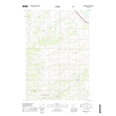
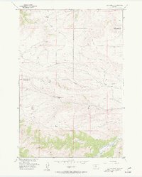
2020 Map of Packsaddle Butte
USGS Topo · Published 2020About this map
Gallatin National Forest lands dominate the southern portion of this landscape, where the namesake Packsaddle Butte rises above a network of deep drainages. The topography is defined by the transition from high ridgelines down to the Yellowstone River in the northeast corner. This drainage system includes several named gulches and coulees, such as Overfelt Gulch and Bear Chip Coulee, which channel water toward larger arteries like Greycliff Cr and Bridger Cr. The map captures a high-elevation ranching and forestry environment where infrastructure is limited to primitive routes like Dee Burns Rd and W Bridger Creek Rd. The presence of the uniquely identified 01S15E22ACCC01 Spring and various creek branches like Log Cabin Cr highlight the critical role of water management in this Montana backcountry.
Find a feature on this map
25 named features on this map. Tap any name to fly to it.
Don’t see what you’re looking for? This feature index may not catch every label — zoom into the map to look around manually.
Map Details
Editions of this 2020 Packsaddle Butte Map
This is the sole edition of this map. No revisions or reprints were ever made.
Other maps of this area

1891 · Big Timber
USGS Topo · 1:125,000

1893 · Big Timber
USGS Topo · 1:125,000

1954 · Big Timber
USGS Topo · 1:24,000
1954 · Ross Canyon
USGS Topo · 1:24,000
1954 · Sliderock Mountain
USGS Topo · 1:24,000

1954 · Billings
USGS Topo · 1:250,000

1955 · Packsaddle Butte
USGS Topo · 1:24,000
1955 · Wildcat Draw
USGS Topo · 1:24,000

1955 · Greycliff
USGS Topo · 1:24,000
1955 · Cow Face Hill
USGS Topo · 1:24,000