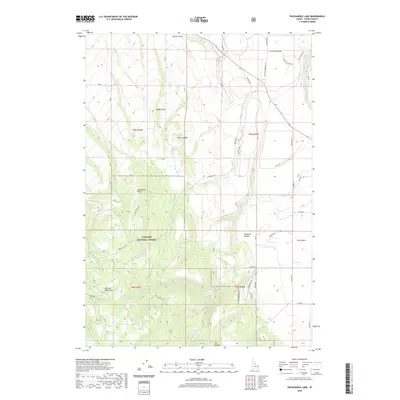
2020 Map of Packsaddle Lake
USGS Topo · Published 2020About this map
Targhee National Forest defines the western high country of this Teton County landscape, where the Big Hole Mountains rise above the agricultural flats of the Teton Basin. The geography is characterized by deep drainages such as Rammell Hollow and Station Gulch, while high points like Baldy Knoll, Grandview Point, and the distinctively named Susies Nipple overlook the valley.
Find a feature on this map
47 named features on this map. Tap any name to fly to it.
Don’t see what you’re looking for? This feature index may not catch every label — zoom into the map to look around manually.
Map Details
Editions of this 2020 Packsaddle Lake Map
This is the sole edition of this map. No revisions or reprints were ever made.
Other maps of this area

1943 · Driggs
USGS Topo · 1:62,500

1943 · Garns Mtn
USGS Topo · 1:62,500

1946 · Driggs
USGS Topo · 1:62,500

1946 · Garns Mtn
USGS Topo · 1:62,500

1955 · Driggs
USGS Topo · 1:250,000

1958 · Driggs
USGS Topo · 1:250,000

1962 · Driggs
USGS Topo · 1:250,000

1965 · Lamont
USGS Topo · 1:24,000

1965 · Packsaddle Lake
USGS Topo · 1:24,000
1965 · Linderman Dam
USGS Topo · 1:24,000