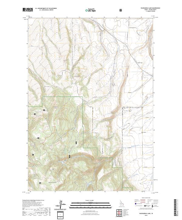
2023 Map of Packsaddle Lake
USGS Topo · Published 2023About this map
The Big Hole Mountains dominate the western half of this quadrangle, transitioning sharply into the agricultural expanse of the Teton Basin to the east. Within the protected boundaries of the Targhee National Forest, the landscape is defined by dramatic topographical shifts from Boldy Knoll and the curiously named Susies Nipple down to the secluded Packsaddle Lake. The drainage network, including Station Gulch and Packsaddle Creek, illustrates the high-elevation water sources that feed the Teton River as it skirts the northeastern corner of the map.
Find a feature on this map
46 named features on this map. Tap any name to fly to it.
Don’t see what you’re looking for? This feature index may not catch every label — zoom into the map to look around manually.
Map Details
Editions of this 2023 Packsaddle Lake Map
This is the sole edition of this map. No revisions or reprints were ever made.
Other maps of this area

1943 · Driggs
USGS Topo · 1:62,500

1943 · Garns Mtn
USGS Topo · 1:62,500

1946 · Driggs
USGS Topo · 1:62,500

1946 · Garns Mtn
USGS Topo · 1:62,500

1955 · Driggs
USGS Topo · 1:250,000

1958 · Driggs
USGS Topo · 1:250,000

1962 · Driggs
USGS Topo · 1:250,000

1965 · Lamont
USGS Topo · 1:24,000

1965 · Packsaddle Lake
USGS Topo · 1:24,000
1965 · Linderman Dam
USGS Topo · 1:24,000