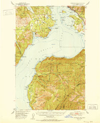
1951 Map of Packsaddle Mtn
USGS Topo · Published 1951About this map
Lake Pend Oreille dominates this mid-century Idaho landscape, its deep waters reaching 2048 feet as recorded in September 1946. Along the eastern and western shores, the map reveals a rugged resource-driven economy, with industrial sites like the Green Monarch Mine, Sulphide Mine, and Minerva Mine dotting the steep ridges of the Kaniksu National Forest. These mining operations, connected by narrow mountain trails and the Northern Pacific railroad corridor near Hope, underscore the region's historical reliance on mineral extraction.
Find a feature on this map
84 named features on this map. Tap any name to fly to it.
Don’t see what you’re looking for? This feature index may not catch every label — zoom into the map to look around manually.
Map Details
Editions of this 1951 Packsaddle Mtn Map
2 editions found
Other maps of this area

1901 · Sandpoint
USGS Topo · 1:125,000

1903 · Rathdrum
USGS Topo · 1:125,000

1909 · Cataldo
USGS Topo · 1:125,000

1911 · Cataldo
USGS Topo · 1:125,000

1911 · Priest Lake
USGS Topo · 1:250,000

1911 · Sandpoint
USGS Topo · 1:125,000

1913 · Priest Lake
USGS Topo · 1:250,000

1949 · Packsaddle Mtn
USGS Topo · 1:62,500

1951 · Packsaddle Mtn
USGS Topo · 1:62,500

1951 · Clark Fork
USGS Topo · 1:62,500