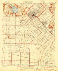
1927 Map of Pacoima
USGS Topo · Published 1939About this map
The San Fernando Mission stands as a central historical anchor in a landscape defined by rapid transition from agricultural estates to organized urban blocks during the late 1920s. This survey illustrates the intricate irrigation and transport infrastructure supporting the north end of the valley, featuring the San Fernando Reservoir and the divergent paths of the Pacoima Wash and Tujunga Wash. The grid system of the Los Angeles City Boundary expands alongside established rail lines, including the Southern Pacific and the Pacific Electric interurban network. Local life is documented through markers like the Saticoy School and the early Metropolitan Airport, while the named tracts of Mission Ex Mission San Fernando hint at the area's massive ranching heritage before the suburban subdivision took hold.
Find a feature on this map
48 named features on this map. Tap any name to fly to it.
Don’t see what you’re looking for? This feature index may not catch every label — zoom into the map to look around manually.
Map Details
Editions of this 1927 Pacoima Map
4 editions found
Other maps of this area

1894 · Los Angeles
USGS Topo · 1:62,500

1896 · Santa Monica
USGS Topo · 1:62,500

1898 · Santa Monica
USGS Topo · 1:62,500

1900 · Los Angeles
USGS Topo · 1:62,500

1900 · Fernando
USGS Topo · 1:62,500

1901 · Southern California Sheet No. 1
USGS Topo · 1:250,000

1902 · Santa Monica
USGS Topo · 1:62,500

1903 · Calabasas
USGS Topo · 1:62,500

1903 · Camulos
USGS Topo · 1:125,000

1903 · Santa Susana
USGS Topo · 1:62,500