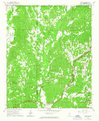
1965 Map of Paden SE
USGS Topo · Published 1966About this map
Mackeys Creek and its many tributaries, including Riddle Creek and McDougal Branch, define the topography of this rural landscape along the border of Prentiss and Tishomingo Counties. In the mid-1960s, a major infrastructure project is visible as the Natchez Trace Parkway is marked as Under Construction through the southern portion of the sheet. This development contrasts with the established network of family cemeteries and country churches that dot the hillsides, such as Trollinger Cem and Jacksons Camp Ch.
Find a feature on this map
35 named features on this map. Tap any name to fly to it.
Don’t see what you’re looking for? This feature index may not catch every label — zoom into the map to look around manually.
Map Details
Editions of this 1965 Paden SE Map
This is the sole edition of this map. No revisions or reprints were ever made.
Other maps of this area

1935 · Holcut
USGS Topo · 1:24,000

1936 · Belmont
USGS Topo · 1:24,000

1936 · Red Bay
USGS Topo · 1:24,000

1936 · Tishomingo
USGS Topo · 1:24,000

1950 · Paden
USGS Topo · 1:24,000

1950 · Altitude
USGS Topo · 1:24,000

1950 · Belmont
USGS Topo · 1:24,000
1950 · Tishomingo
USGS Topo · 1:24,000

1951 · Red Bay
USGS Topo · 1:24,000
1951 · Belmont
USGS Topo · 1:24,000