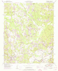
1950 Map of Tishomingo
USGS Topo · Published 1974About this map
The Tennessee Valley Divide snakes through this landscape, separating the intricate network of creek branches that define the region's topography. Along the southern edge, the town of Tishomingo serves as a local hub, situated where the Illinois Central railroad and the historic Natchez Trace Parkway intersect. The map captures a moment when the parkway was still transitioning, with sections marked as Natchez Trace (under construction) near the Alabama state line.
Find a feature on this map
56 named features on this map. Tap any name to fly to it.
Don’t see what you’re looking for? This feature index may not catch every label — zoom into the map to look around manually.
Map Details
Editions of this 1950 Tishomingo Map
3 editions found
Other maps of this area

1911 · Iuka
USGS Topo · 1:48,000

1914 · Iuka
USGS Topo · 1:62,500

1935 · Holcut
USGS Topo · 1:24,000

1935 · Iuka
USGS Topo · 1:24,000

1935 · Leedy
USGS Topo · 1:24,000

1935 · Pleasant Site
USGS Topo · 1:24,000

1936 · Margerum
USGS Topo · 1:24,000

1936 · Belmont
USGS Topo · 1:24,000

1936 · Bishop
USGS Topo · 1:24,000

1936 · Tishomingo
USGS Topo · 1:24,000