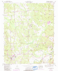
1950 Map of Tishomingo
USGS Topo · Published 1984About this map
Tishomingo and its surrounding countryside in northeastern Mississippi are documented here during a period of transition as the Natchez Trace Parkway was being developed through the region. This 1950 Tennessee Valley Authority survey captures the rugged topography defined by the Tennessee Valley Divide, where complex creek systems like Cripple Deer Creek and Trigger Branch carve through the landscape. The map is a vital record for genealogists, showing numerous country churches such as Boggs Chapel and Mt Glory Church, alongside cemeteries like the Nunley Cem. A notable archaeological detail is the Indian mound located near Cedar Creek in the southeast corner. The presence of the Jackson Spr Pumping Sta and an Oil Well Spring suggest the local infrastructure and natural resource exploration that characterized the mid-century economy of Tishomingo and Colbert counties.
Find a feature on this map
83 named features on this map. Tap any name to fly to it.
Don’t see what you’re looking for? This feature index may not catch every label — zoom into the map to look around manually.
Map Details
Editions of this 1950 Tishomingo Map
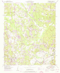
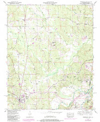
3 editions found
Other maps of this area

1911 · Iuka
USGS Topo · 1:48,000

1914 · Iuka
USGS Topo · 1:62,500

1935 · Holcut
USGS Topo · 1:24,000

1935 · Iuka
USGS Topo · 1:24,000

1935 · Leedy
USGS Topo · 1:24,000

1935 · Pleasant Site
USGS Topo · 1:24,000

1936 · Margerum
USGS Topo · 1:24,000

1936 · Belmont
USGS Topo · 1:24,000

1936 · Bishop
USGS Topo · 1:24,000

1936 · Tishomingo
USGS Topo · 1:24,000