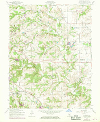
1954 Map of Paderborn
USGS Topo · Published 1969About this map
Paderborn and Floraville anchor this section of the Illinois countryside during a period of transition as the mid-century agricultural landscape met modern infrastructure. The map reveals a dense network of local landmarks essential to rural life, including family-named sites like Martini Cem and St Michaels Cem. These small burial grounds and the presence of several country schools, such as Portland Sch and Rockhouse Sch, suggest the localized community structures of St Clair Co and Monroe Co that preceded the consolidation of the late 20th century.
Find a feature on this map
23 named features on this map. Tap any name to fly to it.
Don’t see what you’re looking for? This feature index may not catch every label — zoom into the map to look around manually.
Map Details
Editions of this 1954 Paderborn Map
3 editions found
Other maps of this area

1910 · Waterloo
USGS Topo · 1:62,500

1912 · New Athens
USGS Topo · 1:62,500

1912 · Baldwin
USGS Topo · 1:62,500

1913 · Waterloo
USGS Topo · 1:62,500

1914 · Baldwin
USGS Topo · 1:62,500

1915 · Renault
USGS Topo · 1:62,500

1940 · Renault
USGS Topo · 1:62,500

1942 · Baldwin
USGS Topo · 1:62,500

1949 · Saint Louis
USGS Topo · 1:250,000
1951 · Columbia
USGS Topo · 1:24,000