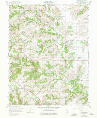
1954 Map of Paderborn
USGS Topo · Published 1975About this map
Paderborn and Floraville anchor this survey of the St. Clair and Monroe county line, capturing a rural landscape defined by legacy farmsteads and family burial grounds in the mid-1950s. The terrain is marked by the winding courses of Gerhardt Creek and Prairie du Long Creek, which carve through the Prairie du Long region. To the south, the Illinois Central Gulf railroad tracks cut across the landscape near New Design (Burksville Station), reflecting the importance of rail transit to these agricultural communities. Genealogists will find significant detail in the placement of several local cemeteries, including St Michaels Cem, St Augustine Cem, and Martini Cem. Educational history is also preserved through the locations of the Rockhouse Sch and Portland Sch, providing a clear record of the area's distributed social structure before mid-century consolidation.
Find a feature on this map
20 named features on this map. Tap any name to fly to it.
Don’t see what you’re looking for? This feature index may not catch every label — zoom into the map to look around manually.
Map Details
Editions of this 1954 Paderborn Map
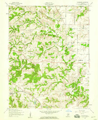
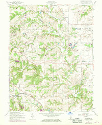
3 editions found
Other maps of this area

1910 · Waterloo
USGS Topo · 1:62,500

1912 · New Athens
USGS Topo · 1:62,500

1912 · Baldwin
USGS Topo · 1:62,500

1913 · Waterloo
USGS Topo · 1:62,500

1914 · Baldwin
USGS Topo · 1:62,500

1915 · Renault
USGS Topo · 1:62,500

1940 · Renault
USGS Topo · 1:62,500

1942 · Baldwin
USGS Topo · 1:62,500

1949 · Saint Louis
USGS Topo · 1:250,000
1951 · Columbia
USGS Topo · 1:24,000