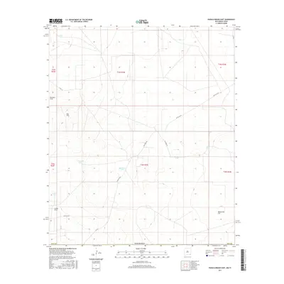
2017 Map of Paduca Breaks East
USGS Topo · Published 2017About this map
Red Hills and the surrounding drainage basins of Red Hills Draw and Salado Draw characterize this southeastern New Mexico landscape. The territory is defined by an essential water infrastructure, where isolated collection points like Penn Tank, W Dinwiddie Tank, and Needmore Tank supported ranching operations across the arid terrain. The map reveals a network of rural access routes, including Battle Axe Rd and Dinwiddie Rd, which connect these remote outposts. To the southeast, the land levels out into Rattlesnake Flat, illustrating the transition from the draws to broader desert basins. This 2017 survey by the U.S. Geological Survey documents the enduring patterns of land use and water management in Lea County, where family-named landmarks and tanks remain the primary identifiers of location in the Chihuahuan Desert.
Find a feature on this map
22 named features on this map. Tap any name to fly to it.
Don’t see what you’re looking for? This feature index may not catch every label — zoom into the map to look around manually.
Map Details
Editions of this 2017 Paduca Breaks East Map
This is the sole edition of this map. No revisions or reprints were ever made.
Other maps of this area

1954 · Hobbs
USGS Topo · 1:250,000

1954 · Pecos
USGS Topo · 1:250,000

1957 · Pecos
USGS Topo · 1:250,000

1958 · Hobbs
USGS Topo · 1:250,000

1969 · Kyle Ranch
USGS Topo · 1:24,000

1969 · Rudd Draw NE
USGS Topo · 1:24,000

1970 · Brunson Ranch
USGS Topo · 1:24,000

1973 · Bell Lake
USGS Topo · 1:24,000

1973 · Paduca Breaks NW
USGS Topo · 1:24,000

1973 · Paduca Breaks East
USGS Topo · 1:24,000