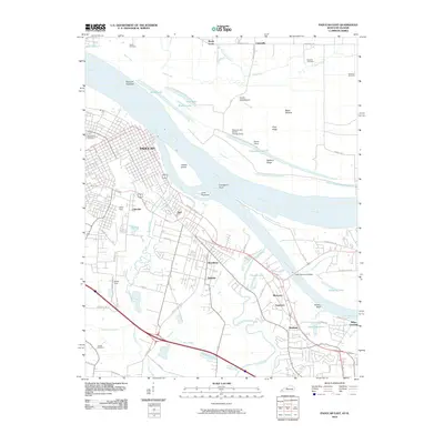
2010 Map of Paducah East
USGS Topo · Published 2010About this map
Paducah and its eastern surroundings are defined by the convergence of the Ohio River and the Tennessee River, a landscape where river transport and industrial rail hubs meet. The intricate layout of the city's street grid, including Martin Luther King JR DR and Wayne Sullivan DR, gives way to established neighborhoods like Littleville, Woodlawn, and Reidland. This 2010 survey highlights the heavy rail infrastructure essential to the region's economy, specifically the massive North Yard and South Yard operations.
Find a feature on this map
76 named features on this map. Tap any name to fly to it.
Don’t see what you’re looking for? This feature index may not catch every label — zoom into the map to look around manually.
Map Details
Editions of this 2010 Paducah East Map
This is the sole edition of this map. No revisions or reprints were ever made.
Other maps of this area

1926 · Paducah
USGS Topo · 1:62,500

1929 · Smithland
USGS Topo · 1:62,500

1929 · Paducah
USGS Topo · 1:62,500

1936 · Melber
USGS Topo · 1:24,000

1936 · Paducah
USGS Topo · 1:24,000

1936 · Elva
USGS Topo · 1:24,000

1936 · Smithland
USGS Topo · 1:48,000

1936 · Symsonia
USGS Topo · 1:24,000

1936 · Benton
USGS Topo · 1:48,000

1936 · Little Cypress
USGS Topo · 1:24,000