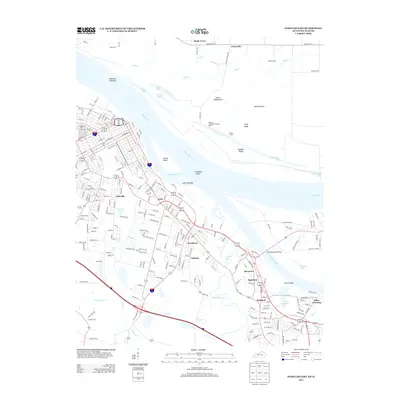
2013 Map of Paducah East
USGS Topo · Published 2013About this map
The Ohio River and Tennessee River converge in this 2013 landscape, defining the industrial and residential growth of the Paducah area. Across the waters, the Illinois shore remains largely dominated by floodplains and backwaters like Allard Lake and Loon Lake, contrasted by the developed Kentucky side where neighborhoods such as Littleville, Tyler, and Woodlawn stretch toward the riverbanks. The Clark Memorial Bridge provides the primary link between these shores, passing over Livingston Point.
Find a feature on this map
50 named features on this map. Tap any name to fly to it.
Don’t see what you’re looking for? This feature index may not catch every label — zoom into the map to look around manually.
Map Details
Editions of this 2013 Paducah East Map
This is the sole edition of this map. No revisions or reprints were ever made.
Other maps of this area

1926 · Paducah
USGS Topo · 1:62,500

1929 · Smithland
USGS Topo · 1:62,500

1929 · Paducah
USGS Topo · 1:62,500

1936 · Melber
USGS Topo · 1:24,000

1936 · Paducah
USGS Topo · 1:24,000

1936 · Elva
USGS Topo · 1:24,000

1936 · Smithland
USGS Topo · 1:48,000

1936 · Symsonia
USGS Topo · 1:24,000

1936 · Benton
USGS Topo · 1:48,000

1936 · Little Cypress
USGS Topo · 1:24,000