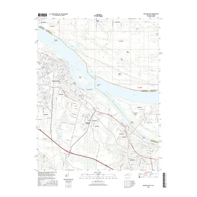
2016 Map of Paducah East
USGS Topo · Published 2016About this map
Paducah sits at the strategic confluence of the Ohio River and the Tennessee River, a geography that has defined this Kentucky river town for centuries. This 2016 survey illustrates the extensive urban grid and suburban expansion into areas like Hendron, Littleville, and Reidland. The landscape is shaped by significant water features, including the sprawling Clarks River wetlands and numerous small lakes such as Allard Lake and Priester Lake that dot the river bottoms.
Find a feature on this map
194 named features on this map. Tap any name to fly to it.
Don’t see what you’re looking for? This feature index may not catch every label — zoom into the map to look around manually.
Map Details
Editions of this 2016 Paducah East Map
This is the sole edition of this map. No revisions or reprints were ever made.
Other maps of this area

1926 · Paducah
USGS Topo · 1:62,500

1929 · Smithland
USGS Topo · 1:62,500

1929 · Paducah
USGS Topo · 1:62,500

1936 · Melber
USGS Topo · 1:24,000

1936 · Paducah
USGS Topo · 1:24,000

1936 · Elva
USGS Topo · 1:24,000

1936 · Smithland
USGS Topo · 1:48,000

1936 · Symsonia
USGS Topo · 1:24,000

1936 · Benton
USGS Topo · 1:48,000

1936 · Little Cypress
USGS Topo · 1:24,000