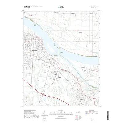
2019 Map of Paducah East
USGS Topo · Published 2019About this map
The Ohio River and Tennessee River converge near Paducah, defining a landscape where waterway commerce and urban expansion meet. This 2019 survey captures the developed riverfront and the intricate network of islands and towheads, such as Owens Island and Cuba Towhead, that shift with the currents. The city's grid extends southeast toward suburban communities like Farley and Reidland, while the Illinois Central RR corridor highlights the historical importance of rail transport in the region.
Find a feature on this map
209 named features on this map. Tap any name to fly to it.
Don’t see what you’re looking for? This feature index may not catch every label — zoom into the map to look around manually.
Map Details
Editions of this 2019 Paducah East Map
This is the sole edition of this map. No revisions or reprints were ever made.
Other maps of this area

1926 · Paducah
USGS Topo · 1:62,500

1929 · Smithland
USGS Topo · 1:62,500

1929 · Paducah
USGS Topo · 1:62,500

1936 · Melber
USGS Topo · 1:24,000

1936 · Paducah
USGS Topo · 1:24,000

1936 · Elva
USGS Topo · 1:24,000

1936 · Smithland
USGS Topo · 1:48,000

1936 · Symsonia
USGS Topo · 1:24,000

1936 · Benton
USGS Topo · 1:48,000

1936 · Little Cypress
USGS Topo · 1:24,000