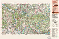
1987 Map of Paducah
USGS Topo · Published 1988About this map
The confluence of the Ohio River and the Mississippi River anchors this regional study, which covers the strategic river hubs and rugged interior of Southern Illinois, Southeast Missouri, and Western Kentucky. In the late 1980s, this landscape was defined by its massive water bodies and public lands, including the sprawling Shawnee National Forest and the Crab Orchard National Wildlife Refuge. Major population centers like Paducah, Cape Girardeau, and Carbondale are shown alongside smaller coal-belt and river towns such as Herrin, Metropolis, and Chester. The map details the complex hydraulic environment where the Tennessee River and Cumberland River meet the Ohio, creating massive impoundments at Kentucky Lake and Lake Barkley. This era represents a period of established interstate travel via Interstate 57 and Interstate 24, while still showing the rail networks of the Illinois Central Gulf Railroad and Missouri Pacific Railroad.
Find a feature on this map
319 named features on this map. Tap any name to fly to it.
Don’t see what you’re looking for? This feature index may not catch every label — zoom into the map to look around manually.
Map Details
Editions of this 1987 Paducah Map
This is the sole edition of this map. No revisions or reprints were ever made.
Other maps of this area

1903 · New Harmony
USGS Topo · 1:62,500

1903 · Patoka
USGS Topo · 1:125,000

1905 · Eldorado
USGS Topo · 1:62,500

1905 · New Haven
USGS Topo · 1:62,500

1906 · New Haven
USGS Topo · 1:62,500

1906 · Eldorado
USGS Topo · 1:62,500

1907 · Morganfield
USGS Topo · 1:62,500

1907 · Weingarten
USGS Topo · 1:62,500

1908 · Galatia
USGS Topo · 1:62,500

1908 · Princeton
USGS Topo · 1:62,500