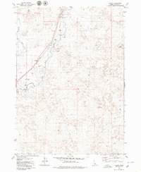
1979 Map of Pagari
USGS Topo · Published 1979About this map
The small settlement of Pagari sits along the Union Pacific rail line in the high desert landscape of Idaho. During the late 1970s, this area was characterized by the presence of a Water Tank and several Borrow Pits that follow the railroad's path, indicating the ongoing maintenance and infrastructure of this transportation corridor. The Little Wood River and Byrns Slough cut through the western portion of the terrain, providing a sharp contrast to the nearby Lava fields and arid ground. The map also captures the isolated Crater Lake to the east and a network of Jeep Trails that traverse the open land. This survey provides a clear view of the intersection between industrial rail utility and the distinct geological features of the Snake River Plain.
Find a feature on this map
13 named features on this map. Tap any name to fly to it.
Don’t see what you’re looking for? This feature index may not catch every label — zoom into the map to look around manually.
Map Details
Editions of this 1979 Pagari Map
2 editions found
Other maps of this area

1954 · Pocatello
USGS Topo · 1:250,000

1955 · Idaho Falls
USGS Topo · 1:250,000

1955 · Twin Falls
USGS Topo · 1:250,000

1955 · Hailey
USGS Topo · 1:250,000

1958 · Twin Falls
USGS Topo · 1:250,000

1958 · Idaho Falls
USGS Topo · 1:250,000

1958 · Pocatello
USGS Topo · 1:250,000

1959 · Hailey
USGS Topo · 1:250,000

1962 · Hailey
USGS Topo · 1:250,000

1971 · Owinza
USGS Topo · 1:24,000