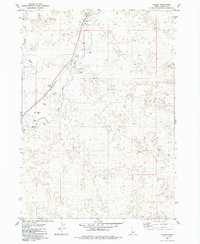
1979 Map of Pagari
USGS Topo · Published 1985About this map
Pagari sits at the intersection of industry and the high desert landscape along the Union Pacific line in southern Idaho. This 1970s survey captures the region's sparse development, characterized by extensive fields of Lava and the winding course of the Little Wood River. The presence of numerous Borrow Pits and a prominent Water Tank near the tracks reflects the infrastructure required to maintain rail operations across this demanding terrain. North of the river, the Jim Burns Slough and the isolated Crater Lake punctuate the arid surroundings, illustrating the complex hydrology of the Snake River Plain. The map meticulously documents the transition between Idaho and Lincoln counties, providing a clear record of the rural land divisions and the network of Jeep Trails that provided access to the remote backcountry during this era.
Find a feature on this map
14 named features on this map. Tap any name to fly to it.
Don’t see what you’re looking for? This feature index may not catch every label — zoom into the map to look around manually.
Map Details
Editions of this 1979 Pagari Map
2 editions found
Other maps of this area

1954 · Pocatello
USGS Topo · 1:250,000

1955 · Idaho Falls
USGS Topo · 1:250,000

1955 · Twin Falls
USGS Topo · 1:250,000

1955 · Hailey
USGS Topo · 1:250,000

1958 · Twin Falls
USGS Topo · 1:250,000

1958 · Idaho Falls
USGS Topo · 1:250,000

1958 · Pocatello
USGS Topo · 1:250,000

1959 · Hailey
USGS Topo · 1:250,000

1962 · Hailey
USGS Topo · 1:250,000

1971 · Owinza
USGS Topo · 1:24,000