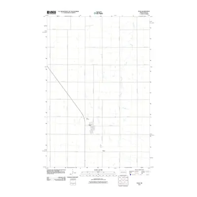
2011 Map of Page
USGS Topo · Published 2011About this map
Page serves as the primary hub of this eastern North Dakota landscape, organized by a strict section-line road grid that defines the local agricultural character. The settlement layout is documented in detail, showing the intersection of residential streets like Argus Ave and Morton Ave just south of the Page Cemetery. The topography is subtly marked by numerous small depressions and prairie potholes, typical of the Red River Valley’s western fringe.
Find a feature on this map
25 named features on this map. Tap any name to fly to it.
Don’t see what you’re looking for? This feature index may not catch every label — zoom into the map to look around manually.
Map Details
Editions of this 2011 Page Map
This is the sole edition of this map. No revisions or reprints were ever made.
Other maps of this area

1952 · Grand Forks
USGS Topo · 1:250,000

1956 · Grand Forks
USGS Topo · 1:250,000

1966 · Grand Forks
USGS Topo · 1:250,000

1966 · Galesburg
USGS Topo · 1:24,000

1966 · Hope SE
USGS Topo · 1:24,000

1967 · Page SE
USGS Topo · 1:24,000

1967 · Ayr NW
USGS Topo · 1:24,000

1967 · Page
USGS Topo · 1:24,000
1967 · Page SW
USGS Topo · 1:24,000

1967 · Colgate
USGS Topo · 1:24,000