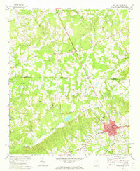
1971 Map of Pageland
USGS Topo · Published 1973About this map
The town of Pageland serves as a hub of activity in this 1971 survey, showing a concentrated grid of streets including Maple St, Evan St, and Maynard St. Situated along the border of the North Carolina and South Carolina state line, the area is characterized by a landscape of small agricultural settlements and numerous country churches that anchored these rural communities. Notable landmarks like the Petersburg School and the Filtration Plant reflect the local infrastructure of the era.
Find a feature on this map
43 named features on this map. Tap any name to fly to it.
Don’t see what you’re looking for? This feature index may not catch every label — zoom into the map to look around manually.
Map Details
Editions of this 1971 Pageland Map
2 editions found
Other maps of this area

1941 · Spartanburg
USGS Topo · 1:250,000

1953 · Spartanburg
USGS Topo · 1:250,000

1960 · Spartanburg
USGS Topo · 1:250,000

1963 · Spartanburg
USGS Topo · 1:250,000

1964 · Spartanburg
USGS Topo · 1:250,000

1968 · Jefferson
USGS Topo · 1:24,000

1968 · Jefferson NE
USGS Topo · 1:24,000
1969 · Taxahaw
USGS Topo · 1:24,000

1970 · Marshville
USGS Topo · 1:24,000
1970 · Wingate
USGS Topo · 1:24,000