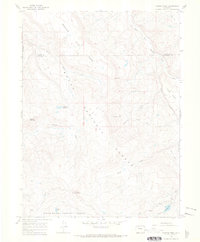
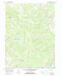
1966 Map of Pagoda Peak
USGS Topo · Published 1969About this map
Pagoda Peak stands as the dominant summit in this high-elevation landscape within the White River National Forest and Routt National Forest. The 1966 field survey documents a wilderness area defined by significant water resources, including the Stinsby Reservoir and the high alpine Vaughn Lake. The terrain is characterized by broad plateaus such as Beaver Flat and Egry Mesa, which are accessible only by a network of jeep trails and pack trails.
Find a feature on this map
22 named features on this map. Tap any name to fly to it.
Don’t see what you’re looking for? This feature index may not catch every label — zoom into the map to look around manually.
Map Details
Editions of this 1966 Pagoda Peak Map
5 editions found
Other maps of this area

1916 · Daton Peak
USGS Topo · 1:62,500

1920 · Daton Peak
USGS Topo · 1:62,500

1924 · Mt. Harris
USGS Topo · 1:48,000

1926 · Mount Harris
USGS Topo · 1:62,500

1954 · Craig
USGS Topo · 1:250,000

1957 · Craig
USGS Topo · 1:250,000

1958 · Craig
USGS Topo · 1:250,000

1960 · Craig
USGS Topo · 1:250,000

1962 · Craig
USGS Topo · 1:250,000

1964 · Craig
USGS Topo · 1:250,000