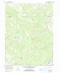
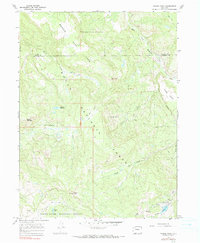
1966 Map of Pagoda Peak
USGS Topo · Published 1990About this map
Flat Tops dominate this high-altitude landscape along the border of Routt and Rio Blanco counties in the mid-1960s. The terrain is defined by a network of drainage systems, including the East Fork Williams Fork and Beaver Creek, which carve through the high plateaus and mesas. This area is situated within the overlapping boundaries of the Routt National Forest and the White River National Forest, highlighting its status as a protected wilderness and watershed region.
Find a feature on this map
20 named features on this map. Tap any name to fly to it.
Don’t see what you’re looking for? This feature index may not catch every label — zoom into the map to look around manually.
Map Details
Editions of this 1966 Pagoda Peak Map
5 editions found
Other maps of this area

1916 · Daton Peak
USGS Topo · 1:62,500

1920 · Daton Peak
USGS Topo · 1:62,500

1924 · Mt. Harris
USGS Topo · 1:48,000

1926 · Mount Harris
USGS Topo · 1:62,500

1954 · Craig
USGS Topo · 1:250,000

1957 · Craig
USGS Topo · 1:250,000

1958 · Craig
USGS Topo · 1:250,000

1960 · Craig
USGS Topo · 1:250,000

1962 · Craig
USGS Topo · 1:250,000

1964 · Craig
USGS Topo · 1:250,000