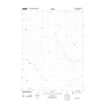
2011 Map of Pah-Rum Peak
USGS Topo · Published 2011About this map
Pah-Rum Peak dominates this high-desert landscape in the southern Fox Range, a region defined by its critical water sources and dramatic canyon topography. This 2011 survey illustrates a network of essential springs that supported life in this arid environment, including Mud Trough Spring, Bull Basin Spring, and Roseberry Spring. The drainage patterns are clearly visible, with North Fork Rodeo Creek and North Fork Coyote Creek carving through the terrain toward the lower elevations of the Smoke Creek Desert to the west. Canyons such as Wild Horse Canyon and Pole Canyon provide natural corridors through the peaks, while broad features like Juniper Flat and Bull Basin suggest areas of relatively level ground amidst the mountains.
Find a feature on this map
21 named features on this map. Tap any name to fly to it.
Don’t see what you’re looking for? This feature index may not catch every label — zoom into the map to look around manually.
Map Details
Editions of this 2011 Pah-Rum Peak Map
This is the sole edition of this map. No revisions or reprints were ever made.
Other maps of this area

1886 · Granite Range
USGS Topo · 1:250,000

1894 · Granite Range
USGS Topo · 1:250,000

1955 · Lovelock
USGS Topo · 1:250,000

1959 · Lovelock
USGS Topo · 1:250,000

1964 · Gerlach
USGS Topo · 1:62,500

1964 · Kumiva Peak
USGS Topo · 1:62,500

1965 · Fox Range
USGS Topo · 1:62,500

1980 · Hog Spring
USGS Topo · 1:24,000

1980 · Smith Canyon
USGS Topo · 1:24,000

1981 · Gerlach
USGS Topo · 1:100,000