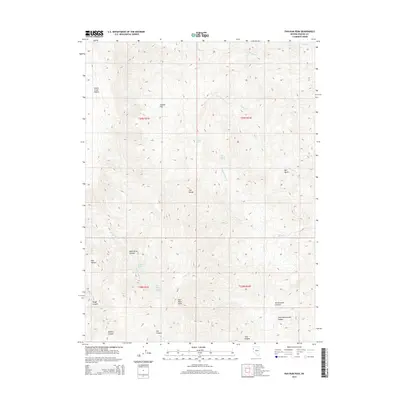
2015 Map of Pah-Rum Peak
USGS Topo · Published 2015About this map
Pah-Rum Peak and the high ridges of the Fox Range dominate this high-desert landscape in northwestern Nevada. The map documents a territory defined by complex drainage systems and isolated water sources, critical for understanding the historical movement of people and livestock through the Great Basin. Deep incisions like Wild Horse Canyon, Mullens Canyon, and Rattlesnake Canyon carve through the terrain toward the eastern edge of the Smoke Creek Desert. Life in this arid environment centers on established water points such as Mud Trough Spring, Bull Basin Spring, and Roseberry Spring. These features, alongside the broad expanse of Juniper Flat, illustrate the geological and hydrological character of the region as it was surveyed in the early 21st century.
Find a feature on this map
29 named features on this map. Tap any name to fly to it.
Don’t see what you’re looking for? This feature index may not catch every label — zoom into the map to look around manually.
Map Details
Editions of this 2015 Pah-Rum Peak Map
This is the sole edition of this map. No revisions or reprints were ever made.
Other maps of this area

1886 · Granite Range
USGS Topo · 1:250,000

1894 · Granite Range
USGS Topo · 1:250,000

1955 · Lovelock
USGS Topo · 1:250,000

1959 · Lovelock
USGS Topo · 1:250,000

1964 · Gerlach
USGS Topo · 1:62,500

1964 · Kumiva Peak
USGS Topo · 1:62,500

1965 · Fox Range
USGS Topo · 1:62,500

1980 · Hog Spring
USGS Topo · 1:24,000

1980 · Smith Canyon
USGS Topo · 1:24,000

1981 · Gerlach
USGS Topo · 1:100,000